Tuesday, October 31, 2006

Forgotten village at the edge of a World Heritage Site


On a densely populated and highly modernized island of Java, some people are still facing difficult and hard life. With small and no steady income to sustain their economy, people in Kampong Cegog must work very hard to make the ends meet. Kampong Cegog is located in the village of Rancapinang; sub-district Sumur, regency of Pandeglang, Banten. Nestled in a hilly area, it is the last settlement before entering the south part of Ujung Kulon National Park, a world heritage site, sanctuary of the last Javan rhinoceros.

Labuan, approximately 3-hour drive southwest from Jakarta, is the town where most people start their journey to Ujung Kulon National Park. Public transportations connect Labuan to villages near the Park, including Taman Jaya, the village where the mountain trek to Cegog awaits.


Mountain Trek
To reach Cegog, there is a trek across the Honje Mountain (approximately 400 m above sea level) from the village of Taman Jaya in the northwest. This trek starts from a relatively flat area of paddy fields and several small settlements. After around 45 minutes of easy walk there is a house for resting that marks the beginning of Honje Mountain. The owner of this house will welcome or politely offer travelers to stop by and have a drink. After a brief pause, the route continues across a small creek and into a denser vegetation of palm trees and rattans. This passage is about 1 meter wide with fallen leaves covering the forest floor and some roots. In the rainy season walking through this route becomes more fun with slippery, or ankle-deep mud, but luckily there are enough trees and hanging roots to hold on to, make sure to grab the ones without thorns, though. Although the sun is fiercely beating down on the landscape, the forest canopy provides enough cover along the way. Throughout the trek, there are some flat segments, but there are numerous steep uphill climbs. Getting used to this terrain, residents from settlements on either side of the Honje Mountain often use this route to travel between villages. Villagers carrying fish and other goods travel along this route to go to and from Cegog. Sometimes, travelers will have to yield or squeeze in order to let other travelers pass in a narrow passage. There is a point called “the tree of affection” where people must “affectionately” hug this tree when passing, for this large tree grow in a narrow hill with slippery floor and deep ravines on both sides. Afterwards there is a resting place by the river, stopping in this spot surrounded by lush green tropical vegetations with birds’ song after a long walk is truly a remarkable experience. A quick face-rinse with water from the river brings back a spark of previously fading spirit. After a long 6-hour walk and about 1.5 liters of drinking water, signs of civilization begin to emerge. Small shelters, sounds of children playing in a distant, and smoke from the kitchens mark the existence of Kampong Cegog settlements. It is the other side of Honje Mountain!

Kampong Life
This settlement is located between two major river streams, Surian river and Cegog river; hence the name Kampong Cegog. Currently, this settlement of approximately 900 people is relying on agriculture for daily subsistence.
Those who have farmland grow rice in their paddy fields, but those who don’t encroach the neighboring National Park, clearing parts of the forest for slash and burn agriculture. Most of these people do not have other options, as they sold their property to buy motorcycles and televisions. With motorcycles to maintain and no land to farm, these people find that household economy is definitely not getting any better. Fortunately, The National Park authority sets aside a stretch of coastal area as a traditional utilization zone where villagers can harvest natural-growing seaweed and sell it to local buyers. This provides Cegog villagers with an alternative way of generating income. Occasionally, Cegog villagers can sell cloves for a reasonable price. Only during that time, they receive good income.

Strangely enough, despite hard and difficult life they face in Cegog, almost all Cegog residents are reluctant to move out. In fact, many outsiders marry Cegog residents and decide to stay in Cegog for good.

Mr. Suganda is one of the residents originating from a village outside Cegog. He used to work for a resort on Peucang Island in Ujung Kulon National Park called Wanawisata Alam Hayati. He made a good living, that he was able to build a brick house and furnished it. Unfortunately, the company’s financial condition now necessitates many employees, including Mr. Suganda, to be laid off. Now, Mr. Suganda must rely on income from opening a small provision shop in front of his house besides farming. Luckily, he also owns a complete set of Video player with sound system. He, then, opens a home cinema where adults and children can view movies, music videos, etc. Entrance fee costs only Rp. 500,- per person.

Unlike Mr. Suganda, most Cegog residents do not own brick houses. Most of their houses are made of woods with woven bamboos as walls. Typical houses are stilt-houses built about 60 cm above the ground supported with several wood pilings. They install either wood planks, or flattened / split small bamboos for floors, and normally have clay tiles for roof. Village’s elementary school is not in a better condition. The walls of the school building came down, leaving only the roof standing. This is not a safe environment for school children, so they have to find other locations. Some good-willed residents offer and turn their porches into classroom where children can study with their teachers. Later on, the students decide to bring building materials and slowly, piece by piece rebuild their school.

Not everyone in Cegog owns in-house toilets and bathrooms. Open-air bathing facilities are available in the nearby rivers. Bathing areas upstream, washing downstream, and toilets further downstream. Distance and several big boulders separate men and women’s sections.

Difficult access is the main constraint for Cegog’s economy. Main access road connecting Cegog with nearby villages is made of loose gravels, stones, dirt roads, and several river crossings. To make life easier, these river crossings are equipped with so-called “bridges” constructed from coconut trunks laid together traversing the rivers. With some balancing skills, these coconut trunk bridges serve the purpose quite well. Unfortunately, there are some crevices between the trunks wide enough for motorcycle’s tire to get stuck in. Some river crossings do not even have anything at all. This road condition makes motorized travel using motorcycles or pick up trucks treacherous in the dry season, and almost impossible in the rainy season. For this reason, crops and other products have to be transported manually using “pikul” –a bamboo pole with loads at both ends carried on the shoulder- most of the time. Buyers purchase crops at a very low price from Cegog villagers, as they have to pay quite a bit for transporting products out of Cegog. With this small income, Cegog villagers will have to purchase goods from outside for a high price, for these goods were also transported to Cegog the same way.
From 6 O’clock In the evening, the noise from diesel-fueled generators is heard throughout the settlement. People pay certain fee for maintenance and fuel to operate these generators, as government’s electricity has not reached Kampong Cegog. Two years ago, these people used kerosene lanterns and solar panels in their houses. At 11 O’clock at night, these generators are shut down right after the home cinema finishes, then, it is peace and quiet once more.


The Surroundings
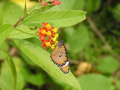
Despite difficult access, Kampong Cegog is worth visiting, as it is surrounded by rugged, yet beautiful terrain consisting of Honje mountain range, coastal forest and sandy beach. This remote place is virtually untouched by tourism (or any other) developments. Javan gibbons (Hylobates molloch) are the prima donna of the Honje mountain. These elusive primates with gray-furred body and dark face are mainly active in the morning, swinging from tree to tree. Nature lovers will also enjoy diverse vegetations of this typical lowland rainforest in the Honje Mountain. Difficult trek with several steep climbs rewards travelers with the sights of interesting plant species such as strangling fig (Ficus sp) and Kiara tree. Crystal clear rivers, occasional sightings of primates, and continuous birds’ singing contribute to the characteristic serenity of the tropical rain forest along the way.

West of Cegog is decorated with beautiful coastal landscape of rocky and sandy beaches. Coastal vegetation consisting of Butun (Barringtonia sp), Ketapang (Cattappa sp), and Pandanus trees accompany the long beach stretch. These coastal vegetations and several caves provide comfortable shelters in otherwise hot and exposed beaches. Rocky beaches retain water in tide pools. These hollow rocks are filled with seawater during high tide, and retains water in low tide. Some species of corals, along with seaweeds, are living in these tide pools, as water is always available. However, rocky beaches are often unfriendly to disoriented boats. Numerous fishing vessels met their demise in this stretch of hard rocky beach. After 3.5 km of rocky beach plus 4 km of sandy beach, another trek leading back to the village of Taman Jaya will take travelers through a less mountainous route with similar tropical forest cover.

Other than being the safe haven for the last 50 of endangered Javan rhinoceros, her exquisite natural beauty qualifies Ujung Kulon National Park to receive World Heritage inscription by UNESCO in 1992. Hard working people of kampong Cegog are living next to one of the world’s most valuable treasures: Nature, the essence of a living planet.


For travel to Cegog or Ujung Kulon National Park, contact KAGUM community eco-tourism. Village of Taman Jaya, Sub-district Sumur, Pandeglang Banten. Call KAGUM at 62 868 12113378 c/o Warca Dinata (kagum@hotmail.com)

Saturday, October 21, 2006

Armored Beasts At The Shadow Of The Himalayas


The City Of Kathmandu
The 4-hour flight from Bangkok did not feel too long, as the Thai Airlines’ Boeing-777 approached the Himalayas from the South. The air traffic controller instructed that the plane take a circular pattern above the airport prior to landing, so the flight took twenty minutes longer than scheduled. This gave passengers the opportunity to gaze at snow-capped peaks of the mighty Himalayas until the plane finally landed in Tribhuvan International airport, Kathmandu.

It was so hazy in Kathmandu that the shadow of the mountains was just barely seen. Temperature was mild at a comfortable 17 degrees Celsius. Tribhuvan was a small airport consisting of only one terminal for departures and arrivals. To enter Nepal, visitors were required to apply for visa upon arrival. This costs US$ 30 for each application, and everyone was granted a visa that was good for 30 days. There were many visitors from all over the world such as Japanese, Korean, and Chinese tourists, as well as Americans and French. They all came for one reason: to admire the magnificent beauty of Nepal and her Himalayan mountain region.

It was February 18, and it was a Hindu holiday with festivities dedicated to the god Shiva. Many devout followers of Shiva went to the temples to smoke opium and consume hashish in tribute to Shiva. Well, at least they only do this once a year during the holiday. Apparently, a parade related to this festivity was the reason for the airspace restriction and air traffic controller’s request for circular pattern above the airport earlier. Sounded like a fun-filled festivity! The bustling city was still influenced by the aftermath of the festival while the three-wheeled tuk-tuks, motorcycles, and other vehicles jammed the small streets.

The city of Kathmandu consisted of tourist area named Thamel, a business district for trading, government offices, residential areas, as well as Central palace and parliamentary. For the past seven years, Nepal was threatened by possible civil war because of the emergence of a group of strong Maoist rebels. For this reason, there are military presences all over the country including Kathmandu. Nepal’s politics was quite unstable with some rebel uprising, student strikes, and other political inconsistencies. These factors had taken a toll in form of the decrease in tourism industry that many Nepalese relied on. The same political situations were also causing constraints for conservation works conducted by colleagues at WWF (World Wide Fund For Nature) Nepal Programs.


Species Conservation Work
Many people were aware of the tallest peak on earth, Mount Everest (also known as Sagarmatha in Nepali), the top of the world. However, not many were aware of the presence of Asian one-horned rhinoceros (Rhinoceros unicornis) in this region. Approximately 600 of these endangered armored beasts were found in Nepal’s Royal Chitwan, Bardia and Sukla Phanta National Parks. Originally, in 1960’s, there were fewer than 100 rhinoceros in Royal Chitwan National Park. Due to continuous efforts on conservation, this number rose to 600 in 2004.

These rhinoceros occupied a region dominated by dry forest, Sal forest, and mixed forests. Due to this vegetation, elephants were extensively used for many activities in the Park. These elephants were not caught from the wild, but were bred in nearby breeding center.
Conservation work on rhinoceros included protection, monitoring and population management. Several rhinos were tagged and equipped with radio collar. This device enabled researcher to follow transmitter installed in rhinoceros’ neck thus following the movement of this particular animal. As the capacity in Royal Chitwan National Park was not sufficient to sustain larger population, some of the rhinoceros were moved (trans-located) to other National Parks with similar topography, and vegetation types. Both radio-collar installation and trans-location involved capture of the selected rhinoceros.


Rhino Hunting!
It was 7:30 in the morning. After spending one night in a jungle resort in Kassara, and having entertained by a group of Nepalese campfire dancers, the capture team was up and ready. Park people and crew from the breeding center readied the elephants. They placed wooden frames on elephants’ backs for comfortable seating. They fastened cushions and frames using ropes tied around the elephant’s belly and tails. The driver would sit on the elephant’s neck, three on the frames, and one would stand in the back, balancing. There went a mean capture machine!

Up to 8 elephants were used to capture the rhinoceros. A team of veterinary doctors was on the back of one elephant with dart rifles, anesthetics, and some chemicals enough to stun an adult rhinoceros. Dr. Mark Atkinson, a Zimbabwean veterinary doctor recommended and brought anesthetic called M99 that he often used in his work in Africa. Park officers, WWF Staffs, and some hot-shot photographers were on other elephant units. The hunt was on. All elephants were scattered in the jungle to cover a large forest/grassland area. Slowly but surely, all these elephants walked over thick vegetations, ravines, and mud in search of the rhinoceros.

They day seemed to drag on until one unit called out from the distance. Two rhinoceros, a mother and its calf, had been sighted! All elephant units formed half circle formation flanking the path of these rhinos. Despite the carefully planned capture formation, the two rhinos managed two escape. They intimidated a unit with a charging pose and created a weak link in the formation. The formation broke loose, and the two slipped away. All units were focusing on these two rhinos. Hunting formation narrowed down and gained on the two.

Adrenaline rushed through our bloods as the targets found themselves cornered again within a tall grass area. Two shooters with dart rifles aimed on the mother, two darts were shot. One hit the neck just between the folds. Another one uselessly hit the thick armor of the back. Again, the half circle formation was established. This time both the mother and the calf charged on to several elephant units simultaneously. Thick dust formed as they charged at speed of approximately 40 km/hour. Their effort paid off, as the formation broke loose again. They took this opportunity to escape once more. A leader unit re-organized the formation and the pursuit was started.

It was a small island of Sal trees in the middle of grass and mud. The rhinos were once again cornered. This time the elephant formation was tight. Since the area was small, two layers of barricade were formed. There was no way for escape. Rhino mother was already drowsy from the drug, but the calf showed aggressive resistance. The baby charged on several times to elephant units. This gesture scared off one elephant, and created havoc among the units. However, the two-layered barricade was too strong to break. In one attempt, the calf charged at full speed. The barricade gave out and the calf was out of barricade, nose-diving into the nearby muddy tall grass. The calf decided to stay out of the game.

A Nepalese shooter jumped onto a tree from his elephant. Nestled between the branches he aimed for the mother rhinoceros. Another shot hit the neck folds, administering more anesthetic drug. All units held formation and waited a while until the target was walking slowly and feebly. It finally lied down and slept under the influence of the anesthetic. Veterinary doctors were watched closely, as the drug took effect. Noting for signs and symptoms the doctors kept their eyes on the sleeping beast. They gave the indication when the situation was safe enough for people to work on the rhinoceros.

Workers eagerly jumped out of their elephants to start taking measurements, install collar with radio transmitter, while they kept the rhino’s skin moist with sprinkles of water they brought in a bucket. These people worked quickly and efficiently. After a short while, the doctors gave a reversal drug to awake the sleeping rhinoceros. Not long, the rhinoceros came around and gained consciousness. Assessing the situation to be still threatening, it charged on to a cameraman that was too eager to take footage that he forgot to climb his elephant. This cameraman ran quick and climbed his elephant and survived the charge. With radio-collar installed, the rhino mother ran into the jungle and looked for its calf. Everyone was satisfied with the process. A big round applause ended the hunt.


Moving The Rhinoceros
Transporting the rhinoceros to Bardia and Sukla Phanta National Parks would involve the same capture procedure as in the radio collar installation. The stunned rhinoceros would be carried and loaded on to a truck that would be waiting not far from the capture site. An animal weighing up to 2 tons would be carefully placed in a cage, and harnessed to the back of the truck for a long journey to the new home.

The rhino population increased steadily over the years, so the area in Royal Chitwan was no longer capable to support larger population. For this reason, some of the animals had to be transported to other locations.

A team of veterinary doctors would escort the journey on Terai Highway connecting Royal Chitwan, Bardia, and Sukla Phanta National Parks. Since 1986, WWF and Nepal government had moved 87 Rhinoceros, 83 to Bardia, and 4 to Sukla Phanta. Unfortunately, due to possible uprising in this region, they would not move the rhinoceros this year. For security reason, this condition might become far too hazardous for both the rhino and the transporters.

Friday, October 20, 2006

Photos For Free Download


Welcome To BERREZ digital!

This blogsite is to provide you with information and photos of animals, wildlife, and nature in general. Photos are available from BERREZ website for free download (small res only...sorry). We have varieties of other photos in linked websites. We dedicate this site for nature photography (we apologize for not providing adult, porn, nude, hardcore, xxx free photos or free pics).
You can follow the stories accompanying the pictures. Kindly visit other links (and also our sponsor banner) to find more photos. Each click on the sponsor banner helps us bring more beautiful free photos for you.
Thank you for your visit. Sit back, relax and enjoy your stay with BERREZ digital